King's Highway
King's Highway
The King's Highway crosses Jordan's high plateaus from Madaba to Petra's edge, linking crusader castles, Byzantine sites and canyon landscapes along one of the ancient Near East's oldest routes.
The King's Highway is one of the ancient Near East's oldest routes. It stretches from Madaba in the north to the Petra and Aqaba region, crossing the high plateaus of Moab and Edom. Caravans, armies and pilgrims have traveled it since antiquity. Today, it's a road route (mainly Highway 35) providing access to archaeological sites, canyon landscapes and historic towns that the faster Desert Highway doesn't reveal.
Quick Practical Info
- Access: car rental strongly recommended; public transport covers certain sections but not all.
- Suggested duration: 2 to 3 days to cover the main route with key stops.
- Usual starting point: Madaba (about 30 km south of Amman).
- Usual endpoint: Petra or Aqaba depending on your chosen itinerary.
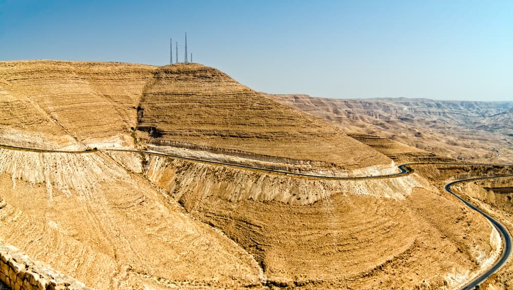
- Road: winding and sometimes narrow through canyon sections; allow extra time.
What You'll See
The route crosses highly varied landscapes: agricultural plateaus, the deep gorges of Wadi Mujib, forested hills around Dana, and sandstone desert toward the south. Key stops include Byzantine, crusader and Nabataean sites. The road also offers views over the Jordan Valley and, on clear days, the Dead Sea.
History and Context
Mentioned in the Bible (Numbers 20-21), the King's Highway already existed in the Bronze Age. It served as a trade route for caravans carrying incense and spices from Arabia to the Mediterranean. The Romans partly integrated it into their network under the name Via Nova Traiana. The crusaders built several castles along it to control passage.
Highlights of Your Visit
Madaba and Its Mosaic Map
The town opens the itinerary with its famous 6th-century Byzantine mosaic map in the Church of Saint George. It depicts the Holy Land and stands as one of the region's oldest cartographic documents.
Mount Nebo
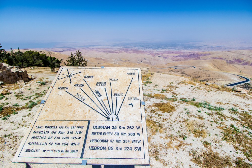
A few kilometers from Madaba, this summit is the place where, according to biblical tradition, Moses viewed the Promised Land. The panorama over the Jordan Valley and Dead Sea is remarkable. A restored Byzantine basilica houses well-preserved floor mosaics.
Wadi Mujib
The Wadi Mujib canyon cuts across the road spectacularly. The descent to the bridge and the ascent on the other side offer breathtaking views. The adjoining nature reserve offers canyon hikes (separate access, toward the Dead Sea side).
Karak and Its Crusader Castle
The fortress of Karak has dominated the town of the same name since the 12th century. Built by the crusaders, it was later held by Saladin and then the Mamluks. The underground galleries and ramparts are well preserved.
Dana Reserve
Further south, Dana is an Ottoman village perched on the edge of a wadi. The nature reserve surrounding it is the largest in Jordan and shelters diverse wildlife and flora. It's a favorite stop for hikers.
Shobak
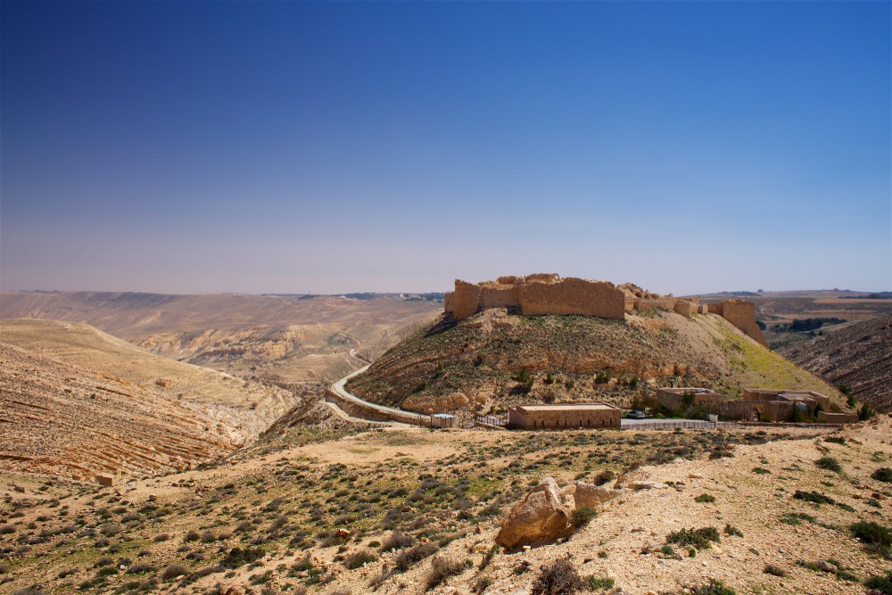
Before reaching Petra, the castle of Shobak (the Crusaders' Montreal) stands on an isolated hill. Less visited than Karak, it offers a wilder atmosphere and unobstructed views over the surrounding hills.
Photography Tips
Morning light is ideal for photographing Wadi Mujib gorges from the road. Karak castle photographs well in late afternoon, when raking light accentuates the stone textures. At Mount Nebo, the panorama is clearest in winter or spring, before summer heat haze sets in.
Location and Access
The King's Highway roughly corresponds to National Road 35, which runs along the high plateaus east of the Jordan Valley. It's accessible from Amman via the Madaba road. A car remains the most practical option: certain stretches between sites aren't served by local buses. Agencies in Amman offer guided tours on this route.
Nearby
- Madaba — city of Byzantine mosaics, natural starting point for the itinerary.
- Mount Nebo — biblical site with panoramic views over the Jordan Valley.
- Karak Castle — crusader fortress dominating the town of Karak.
- Dana Reserve — Jordan's largest nature reserve, ideal for hiking.
- Shobak Castle — isolated crusader fortress, less visited than Karak.
- Petra — Nabataean city, southern end of the itinerary.
Frequently asked questions
Two to three days allow you to visit the main stops without rushing. In a single day, it's possible to connect Madaba to Karak, but sites are then covered hastily.
Car rental is strongly recommended. Local minibuses connect certain towns (Madaba, Karak, Tafilah), but connections between isolated sites like Dana or Shobak are difficult without a personal vehicle.
Spring (March-May) and autumn (September-November) offer pleasant temperatures. Summer can be very hot on the plateaus; winter is cold and sometimes snowy at Karak and Dana.
The Jordan Pass covers entry to several sites on this route, including Petra and certain castles. Check the official list of included sites before departure, as it may change.
Yes. A classic itinerary is to descend via the King's Highway (slower, richer in sites) and return via the Desert Highway (fast, via Wadi Rum), or vice versa.
Madaba, Karak and Dana have hotels and guesthouses. Dana is particularly known for its hiking lodges. Options are more limited between these stops.
Interested in this visit?
We can include it in your personalised itinerary.